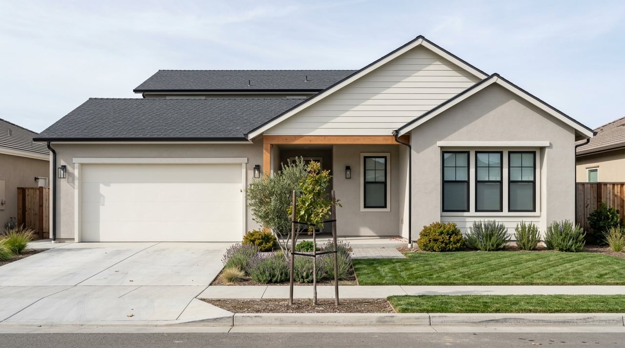
Looking for a home in Roseville and wondering how much parks and trails should factor into your search? In this city, they matter more than many buyers realize. Roseville’s park system and trail network are closely tied to how each area was planned, so the outdoor spaces near a home often tell you a lot about the neighborhood layout, housing style, and daily routine. If you want to compare east, downtown, and west Roseville with more confidence, this guide will help you do exactly that. Let’s dive in.
How Roseville’s park system shapes home shopping
Roseville organizes growth through specific plans that guide land use, traffic circulation, parks, schools, and open space. In simple terms, that means park access and housing patterns often develop together in the same planning area.
For home shoppers, this is useful because the outdoor map is not random. If you are touring homes near a major city-wide park, a trail corridor, or newer open-space areas, you are also usually seeing a certain type of neighborhood pattern at the same time.
The city’s trail network now exceeds 51 miles. One standout is Miner’s Ravine Trail, a 6.36-mile National Recreation Trail that serves both recreation and practical transportation within the city.
East Roseville parks and lifestyle
Maidu Regional Park stands out
Maidu Regional Park is the major east-side anchor. This 152-acre city-wide park includes the Maidu Community Center, Maidu Branch Library, Veteran’s Memorial Rose Garden, Maidu Museum & Historic Site, lighted softball and soccer facilities, a skate park, a basketball court, picnic areas, and a pedestrian and bike path.
For buyers, Maidu is more than a place to take a walk. It works as a larger civic and recreation hub, which can make East Roseville feel centered around established amenities rather than just smaller neighborhood parks.
East Roseville housing patterns
In East Roseville and nearby planning areas, the city blends residential uses with commercial, office, and open-space preservation. That usually translates into a mix of established neighborhoods and homes that may sit near important trail or ravine corridors.
If you are comparing home options here, the appeal is often the combination of established surroundings, access to a major destination park, and proximity to everyday civic amenities. This can feel very different from the newer master-planned sections on the west side.
Downtown Roseville parks and trails
Royer and Saugstad support walkability
Downtown Roseville offers a different outdoor experience. Royer Park is a 17-acre park off Douglas Boulevard and Park Drive that connects to the Downtown Library, Town Square, and historic Vernon Street.
Nearby Saugstad Park adds a dog park, two fields, picnic space, and a bike-trail connection. Together, these parks support a more connected, on-foot style of living in and around the downtown core.
Dry Creek and trail access matter
The Downtown Specific Plan includes Historic Old Town, the Vernon Street District, Royer Park, and Saugstad Park. It also anticipates 1,020 new residential units in a mixed-use, residential-focused core.
Recent trail work has strengthened that pattern. The Downtown Bridges & Trail project created a continuous off-street trail from Sierra College Boulevard to Darling Way, and the city celebrated the grand opening of the Dry Creek Greenway East trail in May 2026.
What downtown may feel like for buyers
If you like the idea of a more walkable setting, downtown and nearby infill areas deserve a closer look. Housing here is less about large-lot suburban living and more about access to parks, trails, and a mixed-use core.
For some buyers, that makes downtown Roseville a strong fit for a connected daily routine. For others, it may serve as a contrast point when weighing established central locations against newer neighborhoods farther west.
West Roseville parks and newer neighborhoods
Mahany and Central create a recreation hub
West and northwest Roseville show the city’s master-planned story most clearly. Mahany Park at Pleasant Grove Boulevard and Woodcreek Oaks anchors a larger civic campus that includes the Roseville Sports Center, Martha Riley Community Library, and Roseville Aquatics Center.
Central Park, off Pleasant Grove Boulevard and Fairway Drive, adds a soccer field, ball fields, playground, pathways, and adjacency to the Mike Shellito Indoor Pool. If you want broad recreation access in a newer-feeling part of the city, this area often stands out quickly.
Hughes and Crabb expand the network
Hughes Park adds extensive walking trails, a lighted soccer field, lighted tennis and basketball courts, a fenced dog park, and creekside open space. Crabb Park brings volleyball, pickleball, tennis, soccer, and water play to a neighborhood-park setting.
For home shoppers, that means west-side parks are not just plentiful. They also offer a wider variety of activity spaces spread across multiple neighborhoods.
Pistachio and Fiddyment show west-side growth
Pistachio Regional Park is a 45.35-acre city-wide park on Westpark Drive with baseball and softball fields, and it was dedicated in 2020. Fiddyment Park includes swings, a zip line, and a covered picnic area.
The Pleasant Grove Creek Trail extension sits west of Fiddyment Road and north of Blue Oaks Boulevard. The city notes that newer neighborhoods typically gain trail amenities as development occurs, which helps explain why this part of Roseville can feel especially park-rich.
What home types you’ll usually see by area
West Roseville and Sierra Vista
West Roseville is often the strongest fit if you want newer master-planned housing with a significant park and open-space footprint. The West Roseville Specific Plan includes 8,792 single- and multi-family units, 704 age-restricted units, 255 acres of parkland, and 705 acres of open space.
Sierra Vista adds 8,679 single- and multi-family units with 106 acres of park and 304 acres of open space. This is one reason buyers looking for newer subdivisions often focus their search here.
Del Webb area
Del Webb is an age-restricted active-adult plan made up primarily of single-family homes around recreational facilities. If that housing format fits your search, it is one of the clearest examples of how Roseville’s planning links homes with recreation-oriented amenities.
Downtown and infill areas
Downtown housing follows a different pattern. The Downtown Specific Plan is mixed-use and residential, so the housing story is more about walkability and smaller-scale urban living than large suburban subdivisions.
North Central, Northeast, and East Roseville
North Central, Northeast, and East Roseville combine residential areas with commercial, office, and open-space preservation around ravines and corridors. If you are shopping in these areas, you are often comparing established neighborhoods with access to city trails, parks, and civic destinations.
Parks and commute considerations
Road access across Roseville
Parks are important, but they are only one part of daily life. Roseville is served by Interstate 80 and State Route 65, which shape how many buyers compare commute options across the city.
The Highway 65 JPA fee program identifies local interchanges at Stanford Ranch/Galleria, Pleasant Grove, Blue Oaks, and Sunset. For west-side buyers in particular, those access points can help frame how one area may function differently from another.
Transit and short bike trips
Roseville Transit provides commuter service to downtown Sacramento, local fixed routes within Roseville, and Arrow on-demand service throughout the city. It also connects riders to Placer County Transit and Sacramento Regional Transit.
For shorter regional trips, the city notes that bike commuting can be practical for commutes under 10 miles. That makes trail access worth considering not just for recreation, but also for parts of your weekly routine.
Trail conditions can vary
Not every trail is usable the same way every day. Some trails are subject to flooding, weather-related closures, or construction detours, especially in low-lying creek areas.
If trail access is high on your priority list, it helps to look beyond a map pin. You will want to consider how a route functions in real life, including seasonal conditions and nearby connections.
A simple way to compare Roseville areas
If you want the shortest version of the Roseville parks-and-housing story, here it is. East Roseville and the downtown core tend to offer established civic parks, trail-adjacent neighborhoods, and more infill-style living patterns.
West Roseville tends to offer newer master-planned neighborhoods, larger park and open-space allocations, and a broader spread of recreation facilities. Neither approach is automatically better. The right fit depends on whether you value established surroundings, walkability, newer construction, or a heavier park footprint.
As you tour homes, it helps to look at parks and trails as part of the full lifestyle equation. They can tell you a lot about how a neighborhood was built, how you may move through it day to day, and what kind of home setting best matches your goals.
If you want help comparing Roseville neighborhoods with a practical, data-driven eye, Rajan George can help you narrow your search based on home style, location, park access, and day-to-day livability.
FAQs
What are the main parks home shoppers should know in Roseville?
- Key parks to know include Maidu Regional Park in East Roseville, Royer Park and Saugstad Park near downtown, and Mahany Park, Central Park, Hughes Park, Crabb Park, Pistachio Regional Park, and Fiddyment Park in west and northwest Roseville.
What is the difference between East Roseville and West Roseville for home buyers?
- In general, East Roseville offers more established neighborhoods and major civic park access, while West Roseville is more closely tied to newer master-planned housing, larger park allocations, and expanding trail systems.
What should buyers know about trails in Roseville?
- Roseville’s trail network exceeds 51 miles, and Miner’s Ravine Trail is a 6.36-mile National Recreation Trail. Buyers should also know that some trails may have flooding, weather-related closures, or construction detours.
Is downtown Roseville a good option for buyers who want walkability?
- Downtown Roseville is one of the city’s clearest options for buyers who want a more walkable setting with access to parks, trail connections, and a mixed-use residential core.
What types of homes are common near West Roseville parks?
- West Roseville, Sierra Vista, and nearby planning areas commonly include newer single-family homes, some multi-family housing, and certain age-restricted options tied to master-planned development.
How do parks help narrow a Roseville home search?
- In Roseville, parks often reflect the broader planning pattern of an area, so they can help you identify whether a location is more established, more walkable, or more oriented toward newer master-planned neighborhoods.